Nestled in the heart of the Green Mountains, Stratton Mountain in Vermont is a hiker's paradise. This stunning region offers an array of trails that cater to all skill levels, from gentle walks through lush forests to challenging ascents that reward you with breathtaking vistas. Stratton Mountain has something to offer whether you're a seasoned hiker or a family looking for a day out in nature. Let's explore the highlights of hiking in this beautiful part of Vermont.
The Allure of Stratton Mountain
Must-Explore Trails
Long Trail – Appalachian Trail
Stratton Pond Trail
Grout Pond Recreation Area
Kid-Friendly Hikes
Planning Your Hike
When to Go
What to Bring
Safety Tips
Other Activities in Stratton Mountain
For a more relaxing experience, visit the nearby towns of Manchester and Weston. These charming towns offer boutique shopping, art galleries, and delicious dining options. The Weston Playhouse is a great spot to catch a live performance, and the Northshire Bookstore in Manchester is a must-visit for book lovers.
Conclusion
Are you ready to live in a Stratton Mountain, Vermont home? Trust the experts at Wohler Realty Group to guide you every step of the way. With unparalleled local knowledge and a commitment to exceptional service, Wohler Realty Group will help you find your perfect property in the beautiful Green Mountains. Contact us today to start your journey toward owning a piece of Vermont's breathtaking landscape. Your dream home is just a call away!
Stratton Mountain Hiking Planning Guide
The overview above covers the highlights. The sections below add what hikers search for next: which parking lot to use, how Stratton Pond works as a day hike or an overnight, and the routes to the fire tower. Trail details come from the Green Mountain Club, the US Forest Service and Stratton Mountain Resort. Our team at Wohler Realty Group wrote this guide for hikers and for anyone looking at Stratton Mountain homes for sale.
At a glanceStratton PondSummitEasy hikesBefore you goNeighborhoodsFAQ
Stratton Hikes at a Glance
Most Stratton hikes start from one of two parking lots on Stratton-Arlington Road, which many hikers also call Kelley Stand Road, or from the resort gondola. The two lots are separate, so check which one your route uses.
Hike | Starting point | Distance | What to know |
|---|---|---|---|
Stratton Mountain summit (Long Trail and Appalachian Trail) | Long Trail and Appalachian Trail lot on Stratton-Arlington Road | 3.8 miles one way, about 7.6 miles round trip. Summit at 3,940 feet. | White-blazed trail to the fire tower, with 360-degree views. |
Stratton Pond (Stratton Pond Trail) | Stratton Pond Trail lot on Stratton-Arlington Road | 3.8 miles to the pond shore, about 7.6 miles round trip. | Gently rolling, blue-blazed trail to the largest body of water on the Long Trail. |
Summit and pond loop | Long Trail lot, returning on the Stratton Pond Trail | 11.5 miles with about 2,200 feet of climbing. | Rated difficult to moderate by the Green Mountain Club. The two lots are 0.9 mile apart by road. |
Fire tower from the gondola | Stratton base area gondola | 0.75 mile each way from the gondola terminal to the fire tower. | Beginner route. The gondola runs seasonally, and its summit terminal sits at 3,875 feet. |
Sources: Green Mountain Club, Stratton Mountain-Stratton Pond Loop and Long Trail Side Trails pages; US Forest Service, Stratton Mountain Trail and Stratton Pond Trail pages; Stratton Mountain Resort, hiking and summer pages. Published distances vary slightly between sources.
Stratton Pond Hiking Guide
Stratton Pond is the largest body of water on the Long Trail, according to the Forest Service, and the most heavily used location on the Appalachian Trail in Vermont. That popularity shapes the rules, so a little planning helps.
Where to park
Use the Stratton Pond Trail lot on Stratton-Arlington Road. The Forest Service puts it about 8 miles west of Route 100 in West Wardsboro, on the north side of the road. The Long Trail lot for the summit is a separate lot about 0.9 mile away by road.
How far it is
The Green Mountain Club describes a 3.5-mile walk on a gently rolling, blue-blazed trail, with the shelter spur at 3.7 miles and the pond shore at 3.8 miles. The round trip is about 7.6 miles.
At the pond
The Forest Service says visitors may see loons or beaver. The shoreline takes heavy use, so stay on durable surfaces and follow Leave No Trace practices.
Camping and rules
Camping is limited to designated sites. The Green Mountain Club's local section says the shelter is first-come, first-served and cannot be reserved, with a caretaker in summer. Horses, mountain bikes and motorized vehicles are not allowed.
Sources: US Forest Service, Stratton Pond Trail page (updated September 2026); Green Mountain Club, Long Trail Side Trails page; Green Mountain Club Worcester Section.
A Stratton Pond day hike, step by step
Park at the Stratton Pond Trail lot
Not the Long Trail lot. Both sit on Stratton-Arlington Road, so check the signs before you leave your car.
Follow the blue-blazed Stratton Pond Trail
The Green Mountain Club describes gently rolling terrain. You will pass an intersection with the Lye Brook Falls Trail on the left. Continue straight to stay on the Stratton Pond Trail.
Reach the shelter spur at 3.7 miles
To get to the water, turn left and follow the pond spur 0.1 mile to the shore, which makes 3.8 miles from the lot.
Stop for lunch, then return the way you came
The Green Mountain Club suggests a detour to the shelter for lunch if you like. The full out-and-back is about 7.6 miles.
Plan extra time if you want the summit too
Stratton Pond sits on the Long Trail and Appalachian Trail, so the climb to the summit is a longer option. The Green Mountain Club lists the full summit and pond loop at 11.5 miles with about 2,200 feet of climbing.
Source: Green Mountain Club, Long Trail Side Trails and Stratton Mountain-Stratton Pond Loop pages.
Overnight rules and fees
Overnight rules at Stratton Pond have changed over the years, and sources disagree on whether a caretaker fee applies. The Forest Service's current Stratton Pond Trail page does not list a fee. Confirm current rules with the Manchester Ranger Station at (802) 362-2307 or the Green Mountain Club before you plan a night at the pond.
Stratton Summit and Fire Tower
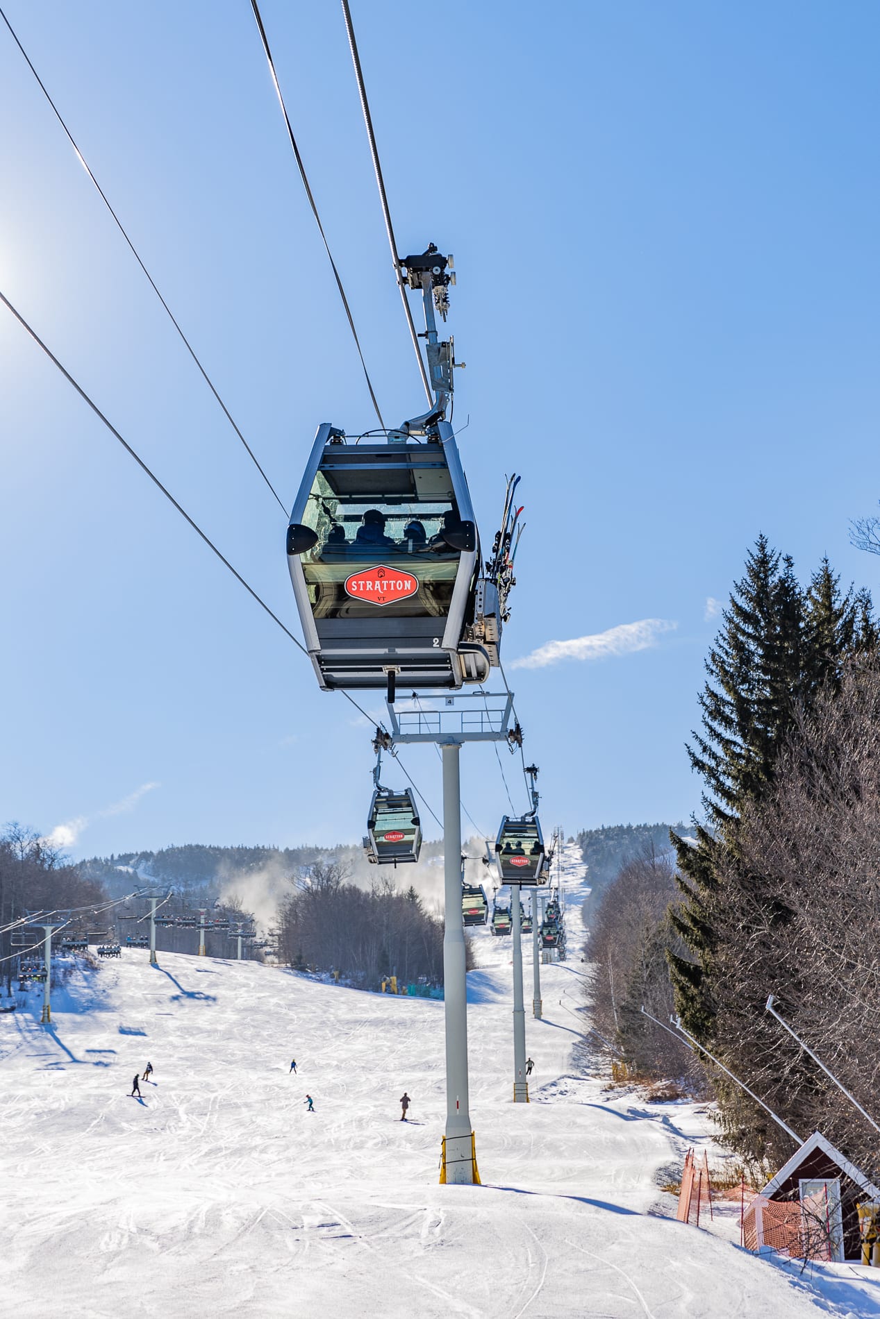
There are two ways to reach the Stratton Mountain fire tower: a climb on the Long Trail and Appalachian Trail from Stratton-Arlington Road, or a gondola ride followed by a short hike.
The Long Trail climb
The Forest Service describes a white-blazed trail that starts gradually, crosses Forest Road 341 at 1.4 miles, then climbs more steeply with switchbacks. Openings along the way look south over Somerset Reservoir. The Green Mountain Club measures 3.8 miles one way to the 3,940-foot summit.
The gondola route
Stratton Mountain Resort lists a 0.75-mile beginner route from the gondola terminal to the fire tower. The summit terminal sits at 3,875 feet. Scenic gondola rides run seasonally, so check Stratton's schedule and ticket details first.
The fire tower
The 70-foot tower was built by the Civilian Conservation Corps, the Forest Service says, and renovated in 2011 by the Long Trail Patrol, according to the Green Mountain Club. The views run 360 degrees across the Green Mountains and toward the Taconic range.
Summit rules
The Forest Service says camping is not allowed at the summit because of heavy visitor numbers and the fragile alpine ecosystem. A Green Mountain Club caretaker is stationed there in summer and fall. Carry out what you carry in.
Sources: US Forest Service, Stratton Mountain Trail page; Green Mountain Club, Stratton Mountain-Stratton Pond Loop page; Stratton Mountain Resort, hiking page and summer blog.
Where two trails began
Stratton's own hiking page ties both long-distance trails to this summit: James P. Taylor's plan for the Long Trail and Benton MacKaye's vision for the Appalachian Trail. Today the two trails share a route over the mountain.
Easy Hikes Near Stratton
If you want something shorter than the summit or the pond, the area has gentler options.
Resort beginner routes
Stratton's hiking page lists beginner loops, including a lower mountain loop and a summit loop, plus the 0.75-mile route from the gondola terminal to the fire tower. The page includes a trail map.
Grout Pond
Grout Pond Recreation Area has more than 10 miles of relatively flat trails, according to the Forest Service. Its guide lists a 0.9-mile Camp Loop and a 2.6-mile Pond Loop, both rated easy. The Pond Loop was scheduled for construction from May to October 2026, so check for closures.
Sources: Stratton Mountain Resort, hiking page; US Forest Service, Grout Pond Recreation Area guide; Recreation.gov, Grout Pond Campground notice (2026).
Before You Go
Conditions and rules change, so check these before you leave.
- Check the Forest Service alerts page for closed or damaged trails.
- Confirm which parking lot your route uses. The Long Trail lot and the Stratton Pond Trail lot are about 0.9 mile apart by road.
- Plan to camp somewhere other than the summit. The Forest Service does not allow camping there.
- If you camp at Stratton Pond, use designated sites only, and confirm current rules and fees first.
- Leave the bike, horse or motorized vehicle at home. None are allowed on the Stratton Pond Trail or the Stratton Mountain trail.
- Check the gondola schedule and ticket requirements if you plan to start from the resort.
- Carry out everything you carry in.
Sources: US Forest Service, Stratton Pond Trail and Stratton Mountain Trail pages; Green Mountain Club; Stratton Mountain Resort.
Match the Hike to a Neighborhood
Stratton's trails sit close to several neighborhoods. The Wohler Realty Group guides below describe each one, and you can browse current Stratton Mountain homes for sale alongside them.
In the village
Long Trail House offers village-side condos, and Village Watch has 2 to 4 bedroom condos with mountain and valley views. Read the Long Trail House calendar for the season on foot.
Trailside at the resort
Mountain Reach has a trailside location in front of the lifts, and Crown Point is a short walk from the Stratton Sports Center. See how owners use Mountain Reach in summer.
Near the resort
North Brookwood sits a short distance from Stratton Resort activities. Compare it with the Stratton Mountain guide and the Stratton Mountain real estate page.
Beyond the resort
Winhall has easy access to Stratton Mountain. Weston and Andover and Peru and Landgrove sit in the wider Stratton and Bromley area. Browse Winhall homes for sale.
Outdoor lifestyle
Our active lifestyle guide covers skiing, hiking, biking and golf. For ideas, read how to spend a day outdoors and things to do in Stratton Mountain.
Buying here
Compare Stratton neighborhoods from village condos to chalets, read about buying a home in Stratton Mountain, or start with our guide for home buyers.
Explore More With Wohler Realty Group
- Meet the Wohler Realty Group team
- All Vermont towns and neighborhoods
- Ski resort guides
- Stratton community guide
- Vermont lifestyle guides
- Dining in Stratton Mountain
- Fall foliage scenery
- Fun with your pets in Stratton
- Top attractions in Stratton Mountain
- Living in Stratton Mountain
- Moving to Stratton Mountain
- First-time buyer checklist for Stratton
- Stratton Mountain homes for sale
- Recently sold properties
- Market reports
Stratton Mountain Hiking FAQ
How long is the hike to the Stratton Mountain fire tower?
Where is the Stratton Mountain trailhead?
How long is the Stratton Pond hike?
Can you camp at Stratton Pond?
How tall is Stratton Mountain?
What is Stratton Pond known for on the Long Trail?
Can I live close to Stratton's hiking?
Thinking about owning near the trails?
Wohler Realty Group has offices in Stratton Mountain and Manchester. Start with the recent sales, or find out what your home is worth with our valuation tool.